


The Allegheny Trail (ALT) is West Virginia’s longest hiking trail, boasting 311 miles. The ALT is 51 years old and managed by the West Virginia Scenic Trails Association (WVSTA), a volunteer-based 501(c)(3) nonprofit. In 2025, this group of selfless volunteers set two new records. The first was attaining 7,007 hours of community service in one year. The second was being recognized by the U.S. Forest Service, out of 154 national forests and 20 U.S. grasslands, as the national winner for the Citizen Stewardship and Partnerships Award, a first for WVSTA and the West Virginia Monongahela National Forest.
In 1958, a scout troop from Charleston, WV, hiked the Appalachian Trail in the Great Smokie Mountains with Troop Leader Doug McGrew. Nick Lozano, who was 15 years old at the time, remembers thinking, “Why should we have to travel to other states to experience the adventure of long-distance backpacking? We have the Allegheny Mountains with their natural splendor to rival the Great Smoky Mountains. Why can’t we have a trail like the Appalachian Trail running through the Mountain State?”
ALT began that day as a dream, and Lozano is one of the founders.
The northern terminus of the ALT is located near the Mason-Dixon Line close to Bruceton Mills, WV. The ALT’s southern terminus abuts the Appalachian Trail on Peters Mountain in Virginia. This is a north-to-south long trail and passes through Preston, Tucker, Randolph, Pocahontas, Greenbrier and Monroe counties in West Virginia as well as Giles and Allegheny counties in Virginia.

The ALT is split into four sections and visibly marked with ALT-branded, bright yellow 2×6 blazes to ensure hikers are on the correct trail. Section one is 95 miles, section two is 92 miles, section three is 68 miles and section four is 60 miles. The ALT is on the hiking app FarOut, which works offline and is recommended to use for safety as many parts of the ALT do not have cell service.
The ALT leads hikers through picturesque areas in six West Virginia state parks, two West Virginia state forests and three U.S. national forests along their journey. Hikers traverse through beautiful farmland on country roads and serpentine deep into the pristine forests of Appalachia. They will also encounter several rural communities making a comeback by embracing sustainable tourism. Many of these towns have been left behind from the coal, timber and railroad industries and are directly seeing the benefits of increased hiker traffic.
ALT hikers cover terrain from 1,045-4,242 feet. WVSTA volunteers have constructed several bridges and kiosks, and there are 12 shelters along the trail. The ALT has some incredible single-track routes that share the High Falls of Cheat access and look down upon the Green Bank Observatory, which anchors the largest steerable radio telescope in the world. ALT hikers also wander through West Virginia’s oldest forest, Seneca State Forest, passing by Thorney Mountain Fire Tower, descending into the Beaver Creek Gorge and treading through the dark sky areas of Watoga State Park.
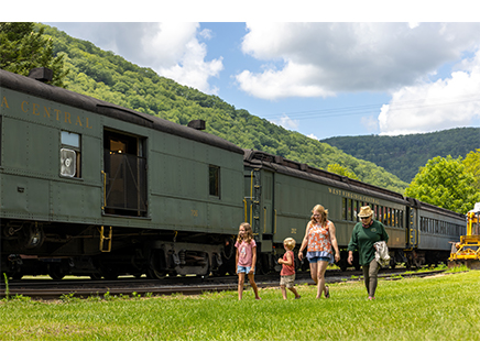
Hikers travel through the remote Allegheny Mountains along tranquil rivers and walk back through history. Many see relics of the past from the Civil War and timber industry and can hear the Durbin & Greenbrier Valley Railroad whistle sing throughout Pocahontas County.
Along the ALT, there are gorgeous overlooks ranging from 2-6 miles round trip, several unique cultural landmarks, great nature views and special photo opportunities. One of the crown jewels on the ALT is Hanging Rock Raptor Observatory in section four. That location has thousands of visitors each year from around the world to see the raptor migration in the spring and fall.
People hike the ALT for a myriad of reasons. Some day hike, section hike and thru hike, while others test their gear, train for a longer trail or do a digital detox. Several new studies highlight the health benefits of just walking in nature and breathing fresh air.